
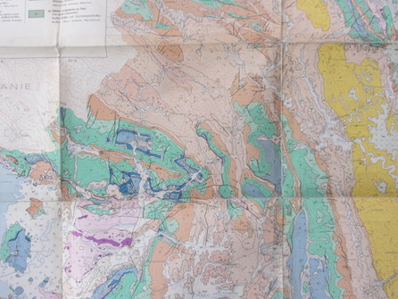
A good old geological map is hard to beat - in this case IFP-IGRS North Epirus (1966)
|
It's not rocket science, but it can transform your and your manager's work
That feel, that look, that smell even, - of a nice big map spread out on the table wide in front of you. There's nothing quite like it really. In our industry we live and breathe maps - a huge proportion of our data is geographically linked - be it geology, geophysics, production data, pressure data, play fairway maps, acreage maps, or operations, facilities, and commercial activity.
GIS is a term that these days people are subconsciously inoculated against, but the meaning is simple. GIS - Geographical information systems - it's MAPS! Maps are our bread and butter. They are everywhere in our industry. "GIS" is simply maps meets computing power. That's got to be good. |
GIS has many applications - wherever there is a geographical element to a data set it can be employed. It really comes into its own when a company is first entering a new country or basin. Visually seeing very quickly what the issues, threats, and rewards are in a particular place is critical. PAETORO is systematically establishing subsurface-focussed country-analysis databases globally, with particular emphasis on our project focus areas.
I was first introduced to the powers of programs like ArcGIS about 20 years ago, started using them in my own work about 15 years ago, and I've been a fan ever since. In a number of companies I have helped to introduce its use, and I have seen the same pattern repeated over again and again. One person who knows how to use ArcGIS does some "grunt" work with data sets and applies it in their job. Other technical people see it and are soon on board, and want to learn more, and get trained in it too. They start doing the same. Then managers start to notice the improved speed and quality of output, and the integration of data that is going on, and start asking for maps they can present to higher management. Soon the requests become frequent enough that a dedicated GIS/data management person is contemplated. Typical cycle length is about 3-4 years to get there! Creative integration of map based data is a great aid to management team investment decisions and integration across disciplines. Yet we don't have to wait that long to get there...
We spend millions and millions on data acquisition yet it is under-utilised if we are not on top of our data sets within our companies. That doesn't mean one particular expert can access one particular set of data in a piece of software which they and a few others can run. Being on top of our data sets means all our technical people and management too, can pull together disparate maps summarising different types of data together quickly, in visually clear ways - and if need be perform sophisticated numerical analysis on how the different data sets relate to each other.
Its really not rocket science getting to that point. ArcGIS (as the best known example of GIS software) isn't that expensive. ArcReader is free with it, and can publish everything that a few ArcGIS trained staff do - to all your team. It takes a bit of hard work and ongoing discipline to assemble data yes, and if you are small you probably won't want to go down dedicated data management staffing routes. All you really have to do initially is recognise that maps are powerful, effective captures of knowledge, and that investing a bit of time to capture them is worthwhile. PAETORO can help you with that. If everybody on your team selects their top 30 most important map based data sets, you might be amazed by what comes out of putting all these maps in one place for everyone to see - in a way that the they can interact not just visually, but mathematically with each other. At the very least it enhances communication between disciplines.
Why spend millions on data acquisition if the information can't be thought about creatively by all the people that need to see it? Great value and unique new combinations of data can be arrived at very quickly, and more often than not, new previously unsuspected opportunities fall out of the analysis.
PAETORO focuses on the G&G data assembly and analysis part of the workflow, where some geoscience input is required. We have our own ArcGIS 10.5 licence to facilitate this.